Seismic Interpretation
We provide a comprehensive range of geophysical data interpretation services (including seismic and geological data analysis). Our expertise includes BSR identification and gas hydrate zone mapping, enabling us to detect significant accumulations of free gas.
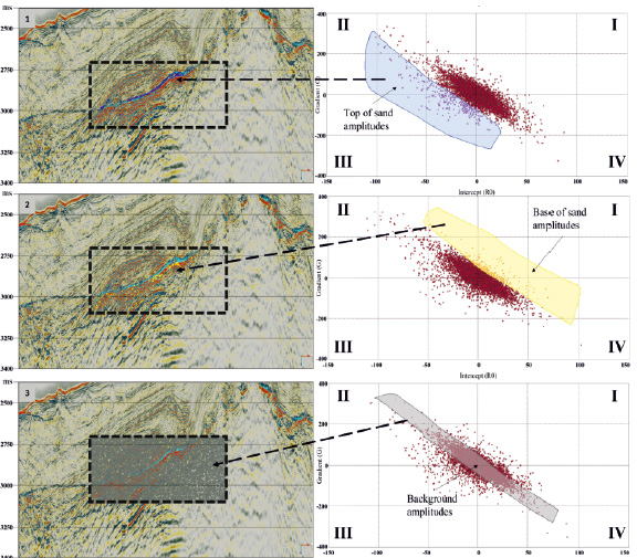
AVO cross-plot analysis
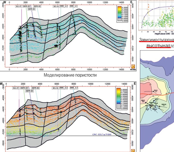
Static reservoir modeling
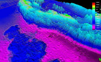
Schematic model showing gas hydrate zone, BSR layers, free gas zone, and migration pathways (left). 3D model of gas hydrate stability zone (right).
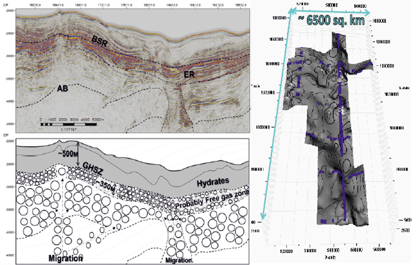
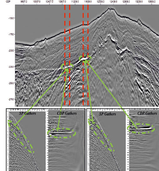
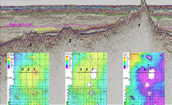
Examples of BSR identification on seismic gathers and time sections
Geological interpretation is one of our core competencies. The specialists of «Target Horizont» possess extensive expertise in petroleum geology, geochemistry, petrophysics, well log analysis, seismic exploration, gravimetry, magnetometry, sedimentary basin modeling, reservoir characterization, and field development.
We offer a full range of geological and geophysical data interpretation services using both conventional and advanced methodologies. Our workflows incorporate leading-edge software, including domestic (Russian-developed) solutions. Our specialists have extensive experience executing interpretation projects across multiple regions of Russia, and world over.
We guarantee the highest standards of professionalism, accuracy, and reliability in our services. This enables our clients to make well-informed and effective decisions in geological exploration and field development.
Completed Interpretation Projects
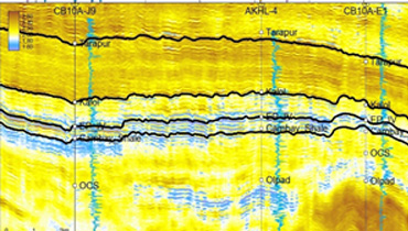
Interpretation of 2D broadband seismic data from the Eastern Shelf and Andaman Shelf of India, extending to the Exclusive Economic Zone (EEZ)
Geological interpretation of 2D broadband seismic data to refine subsurface geology, identify hydrocarbon indicators, and assess petroleum potential across the Eastern Shelf and central deepwater zone of the Andaman Sea.
Interpretation of 2D broadband seismic data in the Andaman deepwater region
Detailed interpretation of 2D seismic data to identify areas of interest and propose exploration targets based on the prospectivity assessment of the territory.
Study of the West Indian Volcanic Margin to assess hydrocarbon potential
Interpretation of vintage data, new 2D seismic surveys, and gravimetric data. Research study to develop a novel geological exploration model for identifying new petroleum provinces.