Modern Gravimetric Monitoring
We provide full-cycle services for implementing gravimetric monitoring at Client's facilities. Gravimetric monitoring involves repeated gravity measurements at established control points. This cost-effective and environmentally friendly method tracks gas-water contact (GWC) movement and gas extraction. A key advantage is its ability to provide areal process characterization.
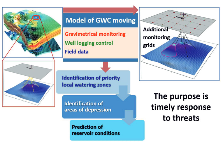
Prediction of localized water breakthrough
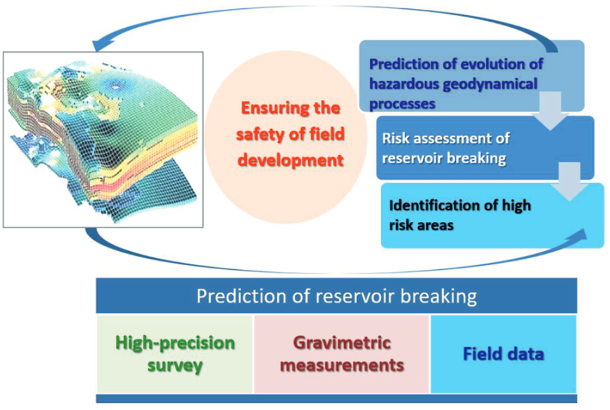
Hazardous geodynamic processes forecasting
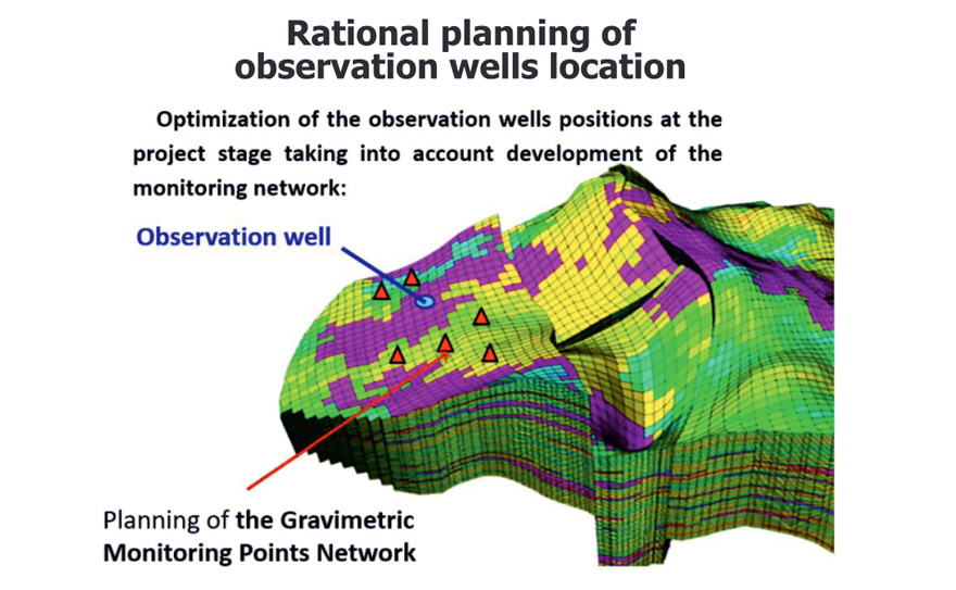
Optimal observation well placement planning
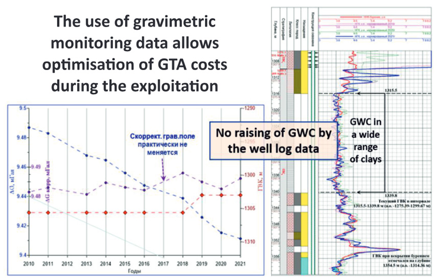
Optimized workover planning
Water breakthrough forecasting based on hydrodynamic modeling
Optimized Workover Planning
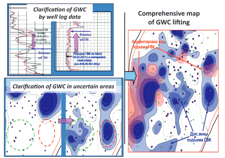
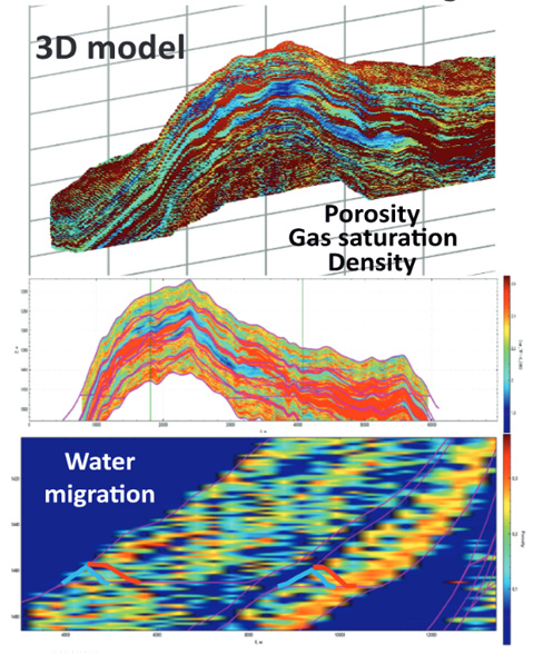
High-Precision Gravimetric Monitoring is an advanced geophysical method based on measuring variations in the Earth's gravitational field. It is used to monitor the development of gas fields and provides critical data on reservoir fluid dynamics (gas, water) and changes in reservoir structure. Key Advantages: Production and Reserves Control Tracks gas-water contact (GWC) movement and assesses reservoir depletion. Optimizes field development by preventing premature water breakthrough in wells. Identification of Heterogeneity Zones Detects density anomalies related to changes in rock saturation (gas/water), refining the geological model. Gas/Water Injection Monitoring Tracks the distribution of injected gas or water during reservoir pressure maintenance (PPM) or underground gas storage (UGS) operations. Economic Efficiency Reduces risks of improper well placement and minimizes drilling costs through more accurate forecasting. Enables real-time gas leak detection, enhancing environmental safety. Non-Invasiveness and Scalability Requires no well intervention, unlike traditional methods (e.g., downhole logging). Applicable to both localized areas and large-scale fields. Integration with Other Methods Gravimetry data complements 4D seismic, hydrodynamic modeling, and satellite monitoring (InSAR), improving interpretation reliability.
As a result, high-precision gravimetric monitoring is a powerful tool for managing gas fields, enhancing production efficiency, reducing risks, and optimizing operations. Its application is particularly relevant for mature fields with complex geology and during the implementation of UGS (Underground Gas Storage) projects.
Completed Monitoring Projects:
Expert Evaluation of Gravimetric Monitoring at the Zapolyarnoye Oil and Gas Condensate Field
Methodological Control of Field Data Processing and Interpretation. Expertise of Geological Results from Gravimetric Monitoring of Field Development.
Processing and Interpretation of Gravimetric Monitoring Data at the Bovanenkovo Oil and Gas Condensate Field
Processing and Interpretation of Data from 3 Field Seasons of Gravimetric Monitoring. Water Breakthrough Prediction in Developed Reservoirs Based on Data Integration.

Field Gravimetric Surveys at Bovanenkovo Oil and Gas Condensate Field
Completion of 3 Field Seasons of Gravimetric Monitoring for Reservoir Development Surveillance